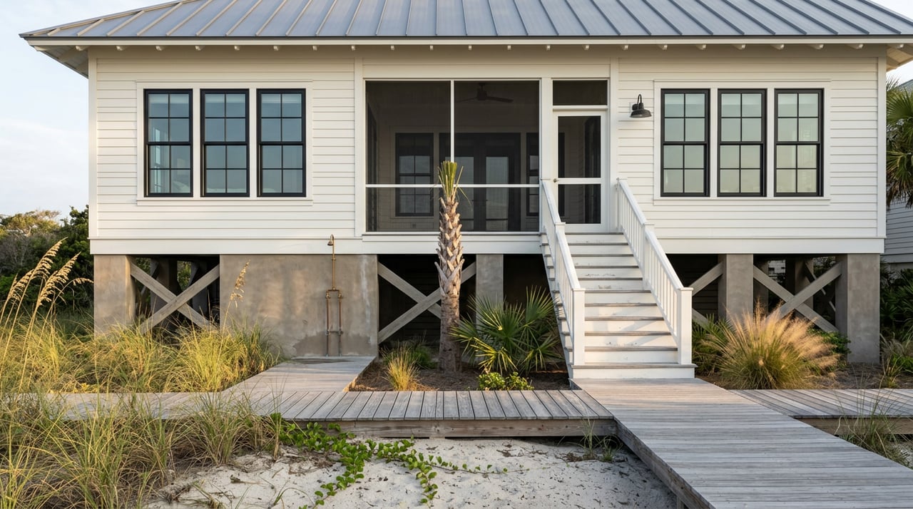
In 2019, an architect working on a lot at 1 Sea Oats Lane, part of the Villas at Coast Cottages on St. Simons Island, submitted plans for a pool, a patio, and an underground stormwater detention system. The property sat in Resort Residential zoning, the kind most buyers on St. Simons Beach assume comes with straightforward permitting. It didn't. Because the majority of the pool and about half the patio fell seaward of a specific line the county had drawn for that lot, the project needed a Conditional Use Permit before a shovel touched the ground, and that permit couldn't move forward until the Georgia Department of Natural Resources issued its own jurisdictional determination for the site.
For buyers considering oceanfront property on St. Simons Island, the parcel-specific setback is an important permitting consideration. This piece explains how the line is set and describes how Glynn County has responded to shoreline erosion.
St. Simons Island's Shoreline Approach
Barrier island beaches erode. That's not controversial, it's geology. What varies is how a community responds, and St. Simons has relied on shoreline armoring.
In 1992, Glynn County considered a $5.2 million plan to pump sand onto a stretch of beach near the King and Prince Hotel, paired with a 453-foot jetty meant to hold the new sand in place. Islanders fought it hard. In Sherpa Guides, environmental writer Taylor Schoettle argued against the jetty, warning that once a beach starts down that road, "you're telling the sea to stand still." The plan was scrapped.
In the years since, the county's default response to erosion on St. Simons hasn't been to pump in sand. It's been to armor the shoreline with rock. St. Simons Island's beach specifically has never been artificially renourished.
That distinction isn't historical trivia. It's active right now. Glynn County began Phase II of its Shoreline Revetment Rehabilitation Project on January 5, 2026, restoring deteriorated sections of the existing rock armor along the oceanfront from Gould Street to Arnold Road. Barge crews mobilized the week of March 2, 2026 to place additional armor stone west of the St. Simons Island fishing pier, with that stretch of work then expected to wrap by mid-March. Engineering documentation on the broader program shows it covers close to 9,300 linear feet across four phases, raises the structure's crest a foot above its original elevation, and has already placed nearly 17,000 tons of granite stone, including a prior phase completed in 2021 that alone used 8,470 tons.
The shoreline approach is the backdrop; the permitting question for an individual property is where its own setback falls.
Where Your Lot Actually Ends
Glynn County's Zoning Ordinance Section 727, the Beach and Dune Protection District, sets a development setback line for oceanfront property. Here's the part that catches buyers off guard: it isn't one number stretched down the length of the island. The line is tied to the toe of the dune on each specific lot, and the county establishes it parcel by parcel.
On November 7, 2019, the Board of Commissioners formally set the development setback for Lot 8 at the Villas at Coast Cottages, 1 Sea Oats Lane, at 40 feet landward of the toe of the dune, measured for that property. That's not a countywide statute you can look up once and carry into every closing. It's a site-specific determination, and it can shift as the dune itself shifts.
The line has also been politically contested. In 2021, the county's planning commission floated reducing the required setback in active dune areas from 40 feet to 25 feet, and increasing it in non-dune areas from 20 to 25 feet, arguing it would bring St. Simons closer to state DNR standards. Commissioner Cap Fendig noted at the time that more than 500 home sites on the island still awaited construction, framing the debate as one about growth as much as safety. Alice Keyes of the coastal advocacy group One Hundred Miles pushed back, arguing setbacks should widen, not shrink, as sea levels rise. The proposal was postponed for further public input rather than decided on the spot.
The takeaway for a buyer isn't which side wins that argument. It's that the number attached to a given lot depends on when it was last surveyed and what the county decided in that specific case, not a fixed rule that stays put for the life of the property.
Two Permits, Not One
Building seaward of that line means clearing two separate gates, not one.
The first is the state's. Under the Shore Protection Act, the DNR's jurisdiction over shore areas is defined in part by where a live native tree 20 feet or taller occurs, or where a structure already existed on July 1, 1979. Anyone planning construction near the beach is expected to request a current jurisdictional determination from DNR's Coastal Resources Division before finalizing plans, whether that's a new pool or simply confirming what an existing home's boundaries already are.
The second is the county's. Once DNR has drawn its line, Glynn County requires a Conditional Use Permit for structures that fall at or seaward of the Section 727 setback. The Coast Cottages case is one example of how this plays out. The DNR jurisdictional determination for that lot was issued September 12, 2019. The application then went through the Islands Planning Commission, where residents Julian Smith and Jeff Kilgore spoke in opposition during the public comment period, before the commission recommended approval.
That sequence illustrates why projects near the setback can require more than a standard county permit.
What This Means Before You Write an Offer
None of this means oceanfront property on St. Simons Beach is a bad bet. It means the permitting timeline is longer and more layered than a typical inland renovation, and it's worth knowing that before you're three months into a contract.
A few practical steps worth taking early:
- Ask whether a current DNR jurisdictional determination exists for the specific lot, and how recently it was surveyed. These aren't permanent; shifting dunes can move the line.
- Don't assume a pool or deck you saw on a neighboring lot means your lot qualifies the same way. The setback is established per parcel, not per street.
- If the home was built before July 1, 1979, that structure itself may factor into where DNR draws its jurisdictional boundary, which is worth confirming with a licensed surveyor rather than guessing.
- Build the full sequence, survey, DNR review, county CUP, and possible public hearing, into your renovation timeline, not just your budget.
A couple of questions buyers ask next
Does every home on St. Simons Beach need a Conditional Use Permit to add a pool? No. The trigger is location, not the island as a whole. Homes set back well behind the dune toe can typically add a pool through standard building permits. It's only construction at or seaward of the Section 727 setback line that pulls in the CUP and DNR review.
How long should I expect the process to take? Longer than a standard permit. The Coast Cottages case illustrates why: it involved a DNR jurisdictional determination and a planning commission hearing with public comment before the commission recommended approval. Plan for that runway rather than assuming a contractor's standard timeline applies.
If you're weighing a specific lot on St. Simons Beach and want to know what its setback history actually looks like before you write an offer, that's exactly the kind of groundwork Lori Lynn works through with clients every week. Let's Connect and figure out what your lot can actually support.
This article is general information, not legal, tax or financial advice. Consult a qualified professional about your situation.